Tuesday, June 25, 2013

Wayne National Forest: Archer's Fork Trail

On May 1, Cool Guy and went hiking after a three week break due to allergies.  It was a bright, sunny, 80 degree day.  We arrived at Archer's Fork trailhead, which is next to an old cemetery, and found one truck with a ramp.  Must be a 4-wheeler.  Never saw nor heard it the whole time.

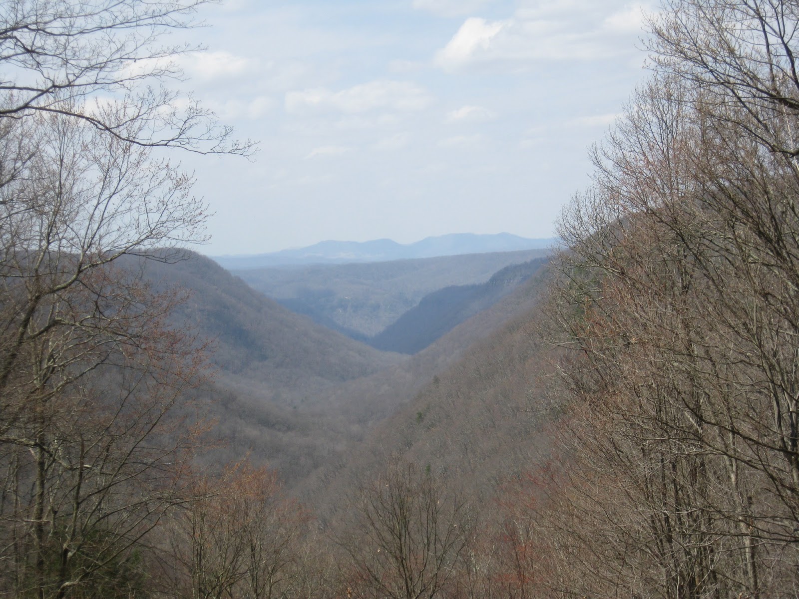
The trail began just down the gravel road from the cemetery.  It was very rough going at first with lots of fallen trees to scramble over or go around, hacking through briers and thorns.  Soon, though, we came to a fork and a sign which pointed the way to Great Cave.  Now the path cleared out, but it was very narrow, very primitive, and tough to hike.  Part of that, I'm sure, is that we were out of shape, but another part was that up went straight up.  No switchbacks, just straight up.

Happily, we were surrounded with myriads of spring wildflowers to distract us from the work.

Eventually, we got to the Great Cave, and it was great indeed.  It reminded me very much of something from Old Man's Cave.  It was huge and cavernous and at one end, water was dripping down over the lip.  We went down to the cave and had lunch.  Unfortunately, there was plenty of evidence of prior visitors: old campfire rings, a little trash, and lots of carved names on the cave walls, some graffiti.

After lunch, we hiked back up to the main path - straight up - and continued until we got to the turnoff for the natural bridge, our primary destination.  It was amazing.  A natural bridge is basically a cave with both ends open.  We went down the ravine, very steeply again (wish I had remembered my stick) and hung out in the shade there for awhile.  We noticed a bird's nest built on the wall of the bridge.  I don't know if that's a cliff swallow or what, but it was very interesting to watch the bird going back and forth to his nest.  We didn't hear any baby birds, so I'm guessing that Mr. Bird was feeding Mama-to-Be Bird.  The nest seemed to be made of moss on the outside, and it looked like a green fuzzy bowl just hanging on the wall.

Finally, we climbed back up to the main trail and headed back.  More uphill going back than going out, but soon enough we were back to the beginning, the car, and some air conditioning.

It was a great day for a hike, and the exercise felt good, plus so much more interesting than, say, a treadmill. (smile)  The bridge was worth the effort, but the overall hiking conditions were some of the most difficult we have seen.


Tuesday, May 7, 2013

McDonough Wildlife Refuge: Zigzag Trail

On May 5, Cool Guy, Scamp and I took advantage of a beautiful day to do a short hike at McDonough.  I'm so glad we did.

Zigzag Trail is probably about 2 miles round trip.  There is a small bit of incline, but it's basically level.  We hadn't been to McDonough since winter, and it was interesting to see how different it looks with spring in full force.  There were plenty of wildflowers on the edges of the path.

It had been fairly dry, so the path was not as muddy as it usually is.  For such a beautiful day, it was strange that we were the only ones on the path.

I think what made the biggest impression on me for this hike is how silent we were and how peaceful it all was.  I never regret hiking.

Friday, May 3, 2013

North Bend SP: Overhanging Rock

On April 14, Burt, Cool Guy, and I did the 1/2 mile Overhanging Rock Trail at North Bend SP.  We just needed 1/10 of a mile to get Cool Guy up to the 25 miles required to earn his walking stick from WV State Parks, so I wanted it to be as painless and easy as possible.

Now, Overhanging Rock is not an easy hike, but it is short, and there is a lot of bang for the buck.  We scrambled uphill and over and around some rocks until it leveled off.  Then down some very unstable stairs, the actual ones that Burt fell down last summer, and then we got to walk along the overhanging rock and the stream at the bottom.

Differences between this time and last summer are that this time, there were some lovely wildflowers blooming, and there were a lot of trees down and a lot of obstruction in the pathways.  I was told by North Bend rangers that they clear out the paths twice a year, so I guess they haven't yet addressed it yet for the summer.

Another really COOL thing was that Burt found a critter skull in the pathway.  It has huge fang teeth, but it is a small, oblong skull.  Of course, we brought it home, stuck it in a bucket of bleach and are hoping to identify it soon.

The weather was fantastic.  Not too hot, not too cold.

Monday, April 29, 2013

Babcock SP

On April 9, Cool Guy and I took quite a long drive down to Babcock State Park.  This is one of my very favorite places.  We hiked the Skyline Trail.  It is 2 miles one way.

The weather was fantastic.  If anything, it was warmer than we would have liked.

The trail starts from a cabin area and immediately goes up at a gentle grade and into a stand of rhododendrons and a lovely down falling stream, like a baby waterfall.  For the upward part, we were surrounded by giant rhododendrons most of the way with some parts of hardwood.  There were some amazing overlooks once we got to the top and leveled off.  I need to add that we just didn't have to climb very high to get way above the world.

Another really cool thing is that for the entire hike, we could hear the water rushing in the river below us.  So we had it all: view, water, sound.

At the end of the trail, we were next to the road.  There was a picnic area and the most amazing view.  We enjoyed our lunch and gazed at the mountains.  We decided to hike back the way we came, but Cool Guy went much, much faster this time, and we made it to the bottom in 25 minutes.  I'm glad we took our time getting to the top and enjoying the scenery on the way up.


Friday, April 26, 2013

Kanawha State Forest, Polly/Birch/Wildcat

On March 30, Burt, Cool Guy, and I took at trip to Charleston to visit Kanawha State Forest and hike.  It was a fantastic day, weather wise, about 60.

Our plan was to take the Polly Trail/Wildcat Ridge loop counter clockwise (supposed to be the easier choice).  It didn't quite work out that way.  The Polly Trail begins on a fire road, and we first missed the turnoff for the trail.  It wasn't marked in any way.  Before we figured out that we had missed it, we had gone quite a ways and had crossed about 5 streams.  Then we backtracked and found the trailhead, went uphill, and had a marvellous hike along about the halfway point up the mountain.  Cool Guy thought it was neat that he could pick up coal from the ground.

After a bit, the trail merged with the fire road again, and it was supposed to do that for a bit and then split off again.  Well, again, we missed the fork, and we were looking for it, too.  Oh, well, we never got to see what the second half of Polly had for us.  Consulting the map, we saw that by keeping to the fire road, we'd be coming to Beech Glen trail, which is also a mountain bike trail.  I just don't see how anyone could enjoy riding a bike on conditions like that.  I think we had to step over fallen trunks and branches about half a dozen times.  Would not like to be hauling a bike over that.

Beech Glen Trail ended up being my favorite part of the hike.  It really was a beech glen, and it was mostly flat, a little more open, less wooded than Polly, running by streams, sometimes across them.

We stopped and had lunch on a fallen log and encountered a few other hikers.  We were the only ones there without dog.

Eventually, Beech Glen intersected with Wildcat Ridge Trail.  To get to Wildcat Ridge, we had to get to the top of the mountain.  Beech Glen did this much more slowly and gently than I think Polly did.  We covered more mileage, but it was not as intense.  It was a nice walk getting to the top.  At the top, we intersected with Wildcat Ridge and then began our descent downhill.  Sometimes this was pretty steep.

Total distance, about 3 miles.  It was a very nice hike, though I don't think quite as nice as Overlook Rock.


Wednesday, April 17, 2013

North Bend, Ten Acre Trail

On April 4, Cool Guy and I went back out to North Bend to hike the Ten Acre Trail.  This is a 3 mile trail designed for mountain bikers.  If hiked in a clockwise direction, it has a slow, switchbacking ascent to the top and then a fairly straight way down.

It was a nice day, about in the mid 40's.  We brought Scamp with us.  He barked nonstop the entire drive in the car.  Right in my ear.

When we arrived at North Bend, we were the only people there besides the park employees.  That always amazes me, especially when the weather is decent.

We began Ten Acre Trail, following the directions and going clockwise.  Cool Guy really liked the way that the upward movement was steady and not too hard to do.  The problem occurred when we reached the top.  Suddenly, there were no markers to be seen anywhere, and we were at the edge of the park boundary.  I checked the map, and it looked like at this point we should be making a sharp switchback and finishing the ascent, but there were no blazes, and no clear trail at all.  We made wide circles around and finally came back down the way we went up.

All in all, I'd say this was a so-so trail.  There weren't any great views, or rock formations, or really anything of real interest.  It was just a nice walk in the woods.  If I drive to North Bend again, I will choose another hike.


Tuesday, April 2, 2013

Conkles Hollow

The entire family went to Conckles Hollow in Hocking Hills SP on March 25.  The weather was mild.  When we started the drive there, it was 30 degrees, and by the time we got home it had risen to about 45.  Perfect weather for hiking.

Conkles is the lesser-known treat of Hocking Hills SP, lagging behind Old Man's Cave.  Though I love OMC, the crowds turn me off.  Conckles is just as nice and has almost no one there.  When we arrived on that Friday morning, there were two other cars in the parking lot.  When we left, there were two other cars in the parking lot.

We did both the Rim Trail (2.5 mile loop) and the Gorge Trail (1 mile out and back).  We began with the Rim, deciding to go clockwise this time.  To get up to the rim, we have to climb a lot of stairs, but once at the top, it's pretty level the whole way.

What was outstanding about the rim trail this time, apart from the fantastic view was the icicles.  We could see them on the rock edges of the canyon, perhaps around a bend, and they were so long.  And then as the day began warming up, we would be lucky enough to see a mass of them crash below.  We got to witness that a few times.

At about the halfway point of the Rim, we came upon the lookout point and the waterfall.  When we had gone last summer, the waterfall was all dried up.  This time, we were lucky.  It was a lovely view across the canyon, and entrancing to watch and hear the water falling.

The opposite side of the canyon had quite a bit of ice on the trail, and that could be a little scary at times.  This side had more solid rock as the trail, and when it was a sheet of ice, it made us nervous about slipping.  There are no guard rails on the edge, and it's at least a 200 foot drop.  We walked very gingerly, and still, Cool Guy, Encyclopedia, and I each slipped once.  We were joking that Burt was next, and he said he'd save it for a big fall.

Eventually, we arrived at stairs bringing us to the floor of the canyon again.  We decided to do the Gorge Trail, which we had passed on last time here.  This trail is concrete paved and is for the enjoyment of those in wheelchairs, baby strollers, etc.  I thought it would be a boring walk, but it was wonderful.

First, there are all the microclimates.  A jungle of ferns here, a cave there, a gathering of slump rocks over there.  It was never the same look twice.  Then we reached the back of the canyon where the concrete ended and the waterfall began.  Oh, my.  This was the highlight of the trip!  Going beyond the sidewalk, onto the path that led us to the base of the waterfall, we were amidst rock overhangs, caves, ice sculptures.  It was so neat to be in the semi gloom, feeling very cold, surrounded by ice and water, and then look backward and see a fern forest behind us, like looking at two different worlds.

The boys had the best time knocking down icicles.  I mean, they were mesmerized for a very, very long time, just climbing among the rocks, finding icicles to knock down, and doing it again.

Burt was over at the foot of the waterfall and suddenly, he slipped.  It was an ice sheet he was standing on, and he went down hard.  The bigger they are, the harder they fall.  Yes, he was right, saving his fall for the grand finale.  Pained a little, but OK.  Nothing long lasting.

Cool Guy said it was the best hike ever, and Encyclopedia actually admitted to have a great time.