Thursday, November 29, 2012

Overhanging Rock Trail, North Bend SP

Another catch-up post.  North Bend State Park is our "local" state park.

Here is my journal entry:
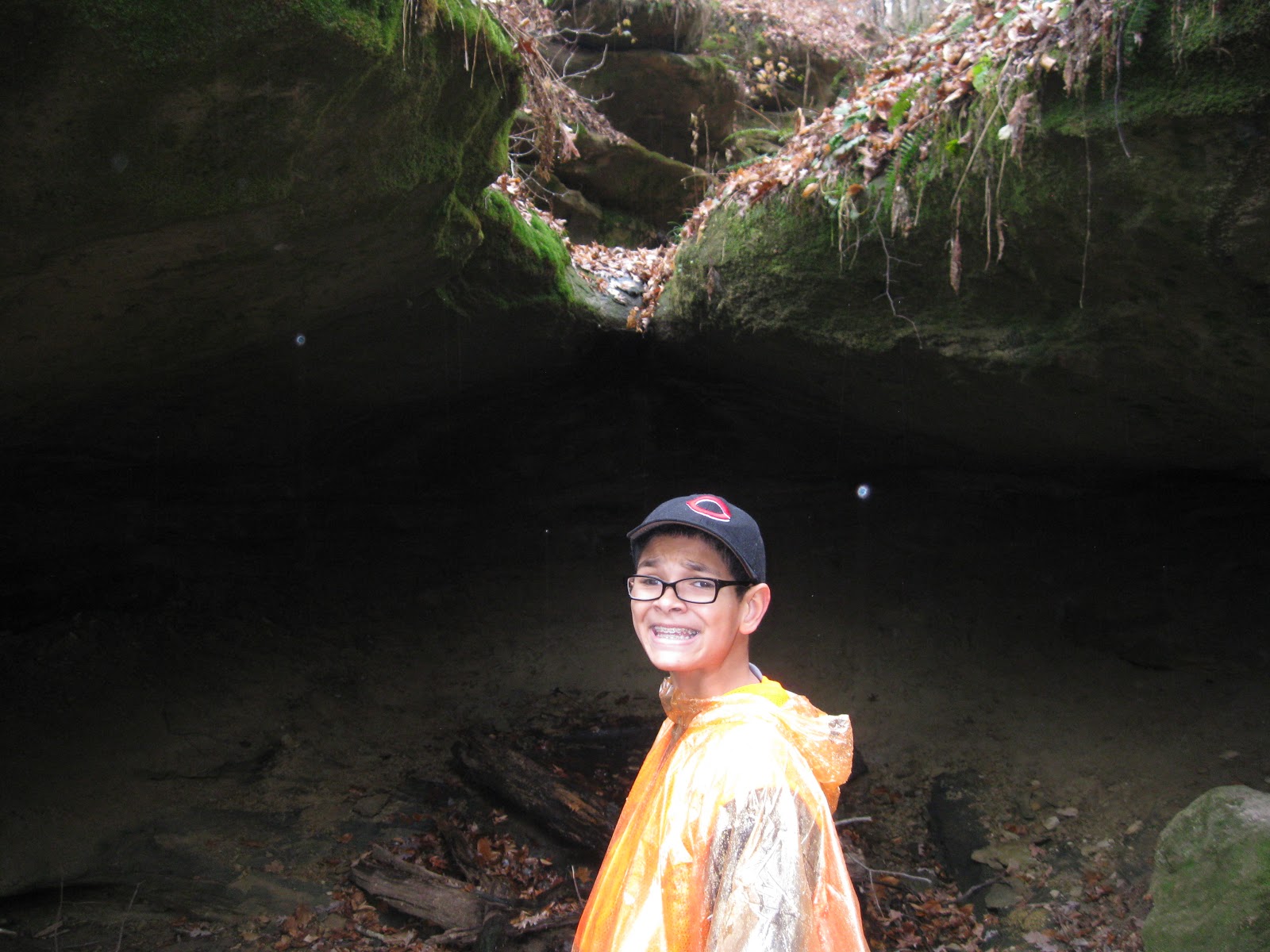
Overhanging Rock
North Bend State Park
August 2012

Encyclopedia, Cool Guy, Burt, and me

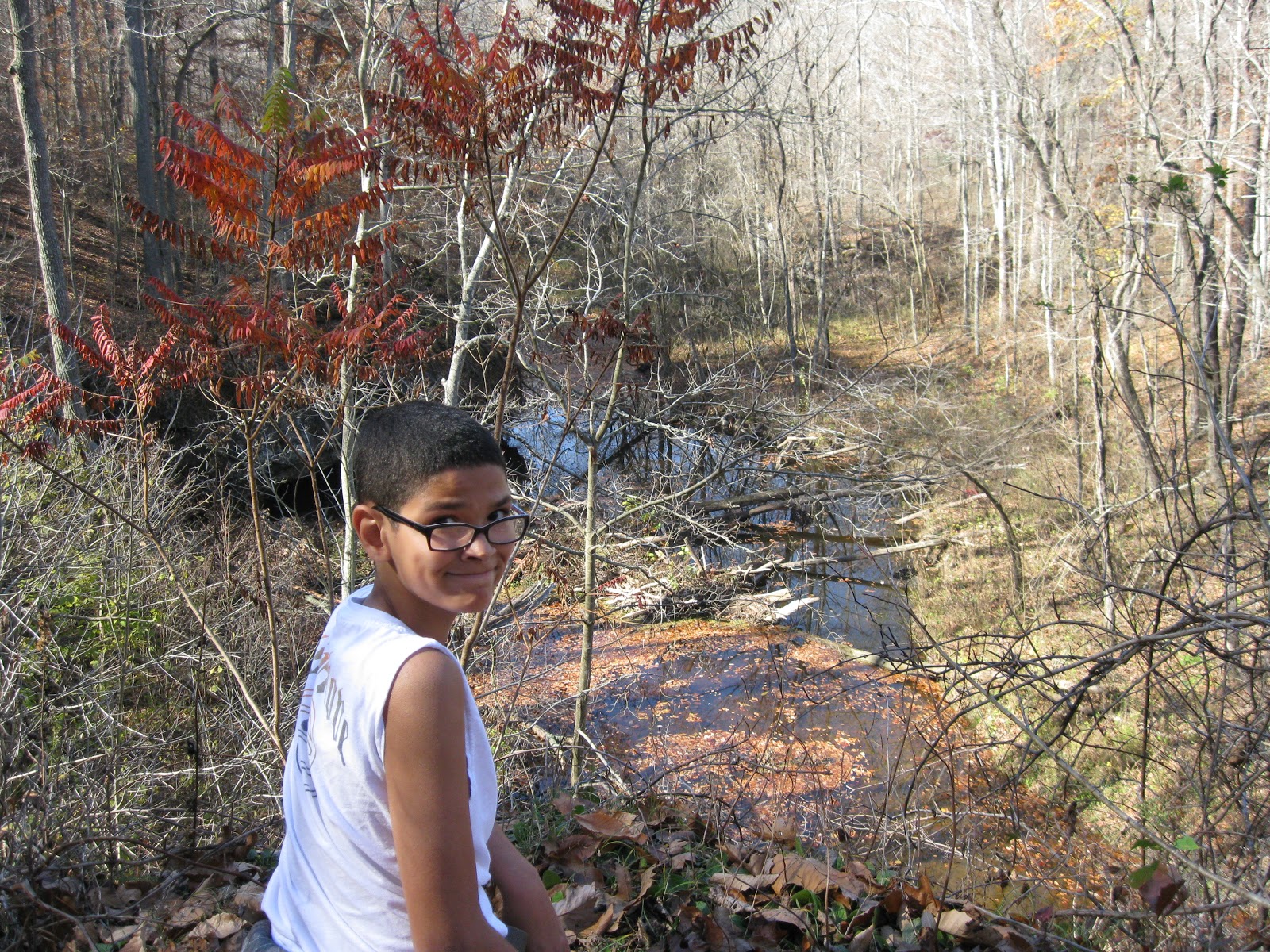
Drizzy day.  Lovely 1/2 mile hike involving some climbing and stairs down a steep slope.  Walk along rocks neat.

Burt fell down the stairs.

That's it.  That's the whole entry.  What I remember is that we had lunch first, and then right as we were about to hike, this amazing storm just blew in out of nowhere.  We were in a picnic shelter and decided to give it a few minutes, and pretty soon, the storm passed.  It was pretty neat seeing it come in.

I also remember that everyone, including Encyclopedia, who claims not to like hiking but secretly does, had a wonderful time.

And that bit about the stairs: remember, it had been raining.  The stairs were wood, and wet, and unlike in Ohio parks, there was no chicken wire over the treads.  Burt fell and fell hard.  And it hurt.  Bad.  You should have seen the bruise.  And the stigmata on his palm.  Now, every time we encounter wooden stairs on a trail, we have to make some joking reference to Burt.  That's what is so great about family: the accumulated experiences and inside jokes that arise from them.  North Bend will always be the place of The Fall.

Burt got some decent boots after the fact.

Crabtree Falls

Since there was no hiking last week ( and the weather was glorious!) due to the opening of buck season and the entire male half of WV out there with guns, and also since my trip for this week got rained out, I've decided to fill in when there are gaps with some hikes that we've done before the blog was begun.  There aren't that many, but they will be out of order from the rest.

The first was my first hiking trip since Burt and I used to hike in the Olympics, over 20 years ago.  My very dear friend, Hilly Holly, arranged to meet me in Waynesboro, Virginia for a few days of hiking, touristing, tennis, and catching up after too many years apart.  She is an avid hiker, and I owe a huge thanks to her for getting me and my family involved in this great adventure.

HH researched the hiking possibilities carefully ahead of time and sent me several to choose from, Crabtree Falls being the winner. My main impressions were that we got off to a late start hiking, due to fuzzy directions from the website, and it was an incredibly hot day.  We didn't begin until 11:00, and we experienced the heat.  I still loved it.  Other vivid remembrances were that I was wearing Encyclopedia's Combat boots since I did not have a pair of hiking boots.  They ALMOST fit perfectly, but that little "almost" resulted in major blisters and pain, so I wisely switched to my running shoes, which I had packed just in case.  And finally, even though I walk the dog about 4 miles every day at a pretty brisk pace, I quickly learned that walking shape is not the same as hiking shape, especially when a mountain is involved.

All of that sounds very negative, and yet, I totally loved it and wondered why in the world it had taken me so long to get back to this.  I took notes in my journal, which I will copy down here.

Crabtree Falls
July 26, 2012
George Washington National Forest

My first hike.  Hiked with HH.  We got lost getting there and didn't get started until 11:00.  Hiked 1.5 miles to the summit, where we lunched with the most glorious view.  Nine switchbacks, lots of stairs, and view of the waterfall in its entirety.

HOT.  105 degree heat index.


That's it.  First hike.  Loved it.

Monday, November 12, 2012

Hope Lake SP, Old Hollow Trail

Cool Guy was off school today for Veterans' Day, so we had a hike planned.  Forecast called for rain later in the afternoon.  No problem.  We set off early and didn't have too far to travel.  Skies were clear.

Our destination was Lake Hope SP, west of Athens OH, and south of Nelsonville OH.  The plan was to start at the Hope Furnace, a very old iron smelting furnace used to make munitions for the Union during the Civil War, hike the Peninsula Trail around Lake Hope and then do a second loop of Old Hollow Trail to get the gorge, caves and waterfall.  That was the plan.

The actuality was that AS SOON AS we put our hiking boots on and donned our orange vests, just in case, though hunting is not permitted, it started to rain.  This, at 9:30 am., not the projected 3:00 pm.  Well, just a few raindrops.  We had hats, and we had rain ponchos, so we put those on, quickly checked out the furnace and decided to do the Old Hollow first because it was short, hope that the rain would stop and then complete things with the Peninsula.

It didn't stop.  It never became a miserable downpour, but it became steady enough that we definitely felt we were hiking through rain, and I never saw Cool Guy so focused on moving forward, making tracks, gaining ground.

Despite the less than perfect conditions, it was a wonderful hike.  The loop was only 1 1/2 miles, but it was an interesting hike with lots of changes and interest.  The trail was easy in that it was very well marked with blue blazes and clear signs.  It was not so easy in its footing.  Hiking through it wet added to the difficulty because there was a lot of up and down, a lot of wooden steps with nothing on them for traction, many steep, some with missing steps.  There were a few fallen trees to scramble over, and one area of the trail was basically water seepage where we had to pick our way through the best we could.

Highlights of the trail included an old pioneer cemetery with engraved sandstone markers, some covered with moss.  Also, at the bottom of the gorge was where a waterfall should have been, but it wasn't wet enough yet, and next to the waterfall place was a really cool rock overhang so deep that it could almost be called a cave.  The whole thing was very lovely.

Another interesting thing about this hike was that we came upon several backpackers, the real kind with great big packs on their backs.  All were headed out.  They had been hiking the Zaliski Trail which shares a bit with Old Hollow.  We saw two men, and then later, two women and a German Shepherd, and at the end, we were being followed by a Boy Scout troop.  I'm assuming that at the start of the rain, the backpackers packed up and headed out.

Also of interest was a beaver dam which we saw at the beginning and end of the loop.  I have never seen one before, but I knew right off that this is what it was.  Pretty neat.

Cool Guy can't wait to go back and bring Burt and Encyclopedia.  It was just a little over an hour's drive, and there is a whole lot of different hiking to do, so we will definitely return.


Sunday, November 11, 2012

Ohio River Islands, Nov. 10

Burt, Cool Guy, and I decided to do a very local hike for this weekend.  We had a lot going on and didn't really have the time to put in a lot of driving.  We chose Ohio River Islands National Wildlife Refuge because  we had never hiked the Upper Trail, which is across the road from the headquarters building.  That trail is on a hill in the woods as opposed to being on the flat floodplain.

What we didn't realize is that beginning Nov. 10, yes, Nov. 10, the very day that we were there, the Upper Trail was closed to hikers until Jan. 1 2013 because of bow hunting season.  Sigh.  It is time to break out the orange vests and chose hikes carefully.  Now, I am not opposed to hunting, and I hope those bow-hunters get lots and LOTS of deer, as we have way too many, but I just wish it didn't interfere with my plans.  Oh well.  It's a very little thing.

So we went to Plan B, which was hiking the Bird and Butterfly Trail, and the River Trail.  It was a fantastic day. The sun was shining, and we were thankful for the breeze because otherwise we would have been too hot in the layers we were wearing.

There were still grasshoppers on the edges of the trails, which surprised us, as we have already had more than one killer frost.  Another thing of note was this wonderful fragrance somewhere among the plants.  There was first a smell like one gets in a craft store full of the dried flowers that usually makes me sneeze.  And then there was another, spicier scent, which, when I asked at the headquarters, I learned was probably Spice Bush.  I'd like to go back and identify it positively sometime.

Also of note was the the path which runs right along the river's edge was completely washed out, as in covered deeply in mud.  There was a line of muddied debris right beyond where the path should have been.  This puzzled us because we couldn't think what would have caused this to happen.  Hurricane Sandy did not get this far inland, and we escaped the Frankenstorm.  All we had was a week of steady rain, but it was just rain, not wind or downpours.  I asked at headquarters and was told that the bottom trail is really just the first tier for the river to expand if it floods, and apparently, a week of rain and a storm elsewhere is enough to cause "flooding."  I'm saying it's not really flooding, just rising a little but still very much within bounds.

Other points of interest on this very short Plan B hike were surprising a dule of dove (that is the group name for dove; I looked it up), finding a bat house on an old dead tree, and finding the most interest tree that grew into a huge arch.  I wonder what caused it to do that.  It may have been that something else was in its way, so it had to grow that way, or there may be another explanation.  I will have to ask the ranger next time.

Total distance of this very easy hike was probably 1 mile.  We finished with lunch at Blacksmith Barbeque, our favorite place to eat and just across the river.  Enjoyed ourselves and learned a thing or two.


Thursday, November 8, 2012

Old Man's Cave

On Election Day, Nov. 6, Cool Guy, Annie Oakley, and I drove to Hocking Hills State Park to hike Old Man's Cave.  It's about 1 1/2 hours to drive there, and we arrived around 10:30.  What really stood out to me was that the parking lot was almost empty.  Old Man's Cave is one of the most popular hiking spots in Ohio, and Columbus is about as close to it as we are.  Every time we have gone there before, it has been a weekend, and the parking lots are full, and we have people in our sight at all times.  This mid-week hiking after the leaves have fallen was a brilliant plan.

One thing about Old Man's Cave is that it really doesn't matter what time of year to hike it.  There is so much beauty and wonder, that one doesn't need fall leaves or spring wildflowers to enhance it, though those are nice bonuses.  But any time of year, it is worth the drive.

We began at Upper Falls and mainly stayed on the gorge trail which allowed us up close views of the falls, pools, and caves, or really, just enormous rock overhangs.  Hiking down the stairs to the gorge, we were struck by all the work that had gone into making this such a hikable place.  My guess is that it was WPA at work in the 30's, building stone walls, hewing steps out of the rocks.  Cool Guy's favorite part was the tunnels through the rocks that the trail took us through.  We did that part twice.

After doing that part twice, we went on down to the Lower Falls, which were even more spectacular, I think.  One scene I think we'll always remember is the family of either Middle Eastern or Pakistani origin.  Two of the men in the group wore swim trunks and actually stood under the falls.  Now, it was a nice day, sunny and 50's, but not a whole lot of sunlight gets to the gorge, and the water was freezing.  It was fun to watch their fun.

After spending some time in the gorge part of Lower Falls, we went up steps and hiked along the rim of it.  Cool Guy found a rock overhang that he could scramble up, with a little help from Annie, and he liked perching on that ledge, just hanging out.  The inside of it, sandstone, was carved with names and initials going back hundreds of years, I think.  It's neat to look at the etchings.

We left Lower Falls and followed the path, thinking we might be heading to Cedar Falls, but we were on the wrong path.  Instead, we found a new area to us, Broken Rock Falls.  It's exactly as it sounds.  Enormous, ENORMOUS rocks lie about as if some giant child had flung them.  They are house size and covered with moss, lying at odd angles.  At the end of the trail, way up top, there was a small stream of water falling down onto the rocks.

The rest was just backtracking, finding another tunnel with stairs leading up to the top and back to the parking lot.

In some ways, this was an easy hike.  To see all these wonders, one really only need hike about a mile.  We kindof did everything twice, sometimes on the rim, sometimes in the gorge, and sometimes going back for a second view, so my guess is that we covered between two and three miles.  The paths are very clear and well-worn.  No getting lost, no scrambling over trees, roots, rocks.  But there are a lot of stairs, some steep and narrow carved into the rocks, others easy and wide.  I would say in general it is an easy hike, and that is obvious by the number of people who are able to bring their children and the number of people with dogs.  But it can be made as challenging or as easy as you'd like.  Cool Guy certainly exerted himself more than the average hiker, walking ahead of us, coming back to hurry us up, climbing all over the place.

Hocking Hills SP is always worth the drive.  Next time, we will do Cedar Falls and Ash Cave, hopefully all in one outing.


Saturday, November 3, 2012

Audra State Park

Today, Cool Guy and I traveled two hours to Audra State Park, near Buckhannon WV.  Burt warned me ahead of time that there might be snow, due to the Frankenstorm resulting from Hurricane Sandy colliding with a huge winter front.  We saw on Weather Channel that this had greatly affected the Snowshoe area, but I figured that Audra was far enough away from Snowshoe that it would have minimal impact.  My mistake was complacency due to my own area not being affected and lack of follow up by the media which focused instead on the aftermath of Sandy in the Northeast.

Lesson learned: check ahead of time if weather just might be an issue.  Why am I always learning lessons the hard way?

The drive down there was easy with no mishaps, but it was like an invisible wall.  As soon as we were about 10 miles away from Audra, suddenly there was snow.  First a little on the mountains, then snow covering all the ground.  But we're talking inches, not feet.  I wasn't worried.

What I wasn't aware of was that there was WIND to go with that snow in the Frankenstorm.  Having suffered greatly last July from a freak wind storm, losing power for 5 days of extreme heat, lines down, trees down everywhere, no water, no ice, I know what a major storm can do.  When we got to Audra, it looked pretty bleak.  Suffice it say, we were definitely the only ones there.  Snow was everywhere.  But trees were down everywhere, too.  What I had expected to be an easy hike turned out to be impossible to do if I wanted to do it safely.  Power lines lay across trees, which blocked trails.

Cool Guy and I wandered around a bit, looked at the damage, admired the incredibly beautiful Middle Fork River, and speculated what a future hike here will entail.  We are definitely going back, but giving the Rangers at least a month to get things back to normal.

We will definitely call ahead.


Total distance: probably 1 mile.  Difficulty: hard.  Couldn't walk 5 feet without navigating over, under, or around a tree.

Saturday, October 27, 2012

Kroger Wetlands

Burt, Cool Guy, and I bundled.  That is, we combined a hiking trip with a grocery shopping trip.  I love to combine things in trips, being the super-efficient person that I am.  Ha.  When it works out that way, great.  This morning, I knew that I had had to go grocery shopping, and I really wanted to do a hike.  Nothing huge like Fort Hill, just a little, local hike.  Kroger Wetlands was just the ticket.

It is located behind (surprise) the Kroger store in Marietta OH.  My guess is that the land was donated by Kroger, but I don't know for sure.  The trail is maintained by a local hiking group, and we could tell that a lot of time and care has been put into it.

The main attraction of the Kroger Wetlands is, duh, the wetlands, which means lots and lots of migrating birds.  There is the water, the marshes, the bugs, the wildflowers: all wonderful things for the birds, and all in an island of solitude in the midst of urban/interstate sprawl.  It was hard to believe that we were so close to the hotels, highways, and, yes, grocery stores, but it felt that we were miles and miles away.

The trail was just a flat, simple loop.  Nothing fancy.  We had glimpses of the marsh area and sometimes the path went right up to it.  There were two observation decks, and several signs identifying the birds and plants.  We saw lots of ducks, cattails, lots of other marsh plants, and we heard lots of birds, but I'm afraid that we were making a little too much noise and weren't still enough for long enough for the birds to begin to come out.

You see, it was drizzling all morning.  I had to use my best persuasion to get the guys to even consider coming out, but I knew once we got hats on, as long as it wasn't really really raining, then we'd be OK.  And we were, but at the same time, we also weren't going to just sit waiting for birds to show up.  That will have to be for another trip.

I think the highlight of our walk was finding the tree trunk 3/4 chewed through by a beaver.  I don't think I've ever seen that before.  We noticed that many, maybe most, trees near the water's edge had been wrapped in a wire mesh, probably to keep them safe from beavers.  I'm sure it's difficult deciding whether and how to best manage various animals' and humans' interests, as in why it would be more important to allow a tree to live rather than let the beavers set up housekeeping in the wetlands.  I'm not doubting or disputing the decision to wrap the trees, but I am curious about the reasoning behind it.


For a little bitty, flat, 1 mile loop, we certainly saw a ton of neat things, breathed some fresh outside air, and really enjoyed our time, drizzle and all.


Friday, October 26, 2012

Fort Hill Memorial

No school on October 25, and the forecast was sunny and 80.  We were headed out.  Poring through the Falcon Guide, Hiking Ohio, I decided that Fort Hill was a good destination for an all-day adventure.  It WAS a day of adventure and some lessons learned.

I had slightly underestimated the drive there.  It was 2 hours on Hwy. 32 before we got to the turnoff at Peebles Ohio.  Good thing we had gotten an early start.  Once on 41, it was definitely rural farm country.  In fact, a chicken crossed the road in front of me.  I asked why. :-)

Fort Hill was easy to find, with loads of parking, a museum which was closed on weekdays, lots of picnic shelters, and we were the only ones there.  Lovely.  According to the website, we could pick up trail maps there, but although there was a box for them at the trailhead kiosk, the box was empty.  I had copied the pages from my book, which included a sketchy map, and we forged ahead.

We took the Gorge Trail and picked up the Fort Trail to end the hike.  Total distance was 4 miles.  The website warned that the trails were primitive, though I would say that they were fine and easy to see, just not wide and well-groomed.  The book also mentioned a lot of up and down, and looking back, I'd say we did spend most of our time going either up or down.

It was incredibly beautiful.  The leaves were about 75% fallen and what was left was gorgeous.  The Gorge trail followed along a stream most of the way, and it seemed like every 5 minutes there was a new and different scene: either a view of the crystal clear stream below, or an outlook over the area, or deep in various stands of trees, or walking among overhanging rocks.  It just couldn't get monotonous.  At one point, the trail even took us THROUGH a log cabin.  Finally, I said that we just had to stop taking pictures or we'd still be around at dark.

We stopped for our picnic on a moss-covered outcropped overlook, which was about the halfway point.

Things got a little confusing at the point where we were supposed to pick up the Fort Trail.  Our guide just said there'd be a sign.  Unfortunately, there wasn't, but there were other signs and quite a few intersections to choose from.  That is where the trail map would have come in very handy, and lesson learned is to download and print one out beforehand.  This caused Cool Guy some anxiety because by this time, he was very tired.  But as we were resting on a log, two other hikers came by and assured us we were on the Fort Trail and headed to the end of the hike.  Whew!

The Fort Trail was much easier, with a gentle but steady incline up one side of an ancient Indian mound and then back down.  It was strictly through hardwoods and we shuffled through ankle deep leaves and scrambled over, under, and around giant fallen trees across the path.  At one point, we surprised a flock of turkey buzzards.


Total time hiking was 4 hours, and as soon as we headed back home, Cool Guy fell asleep.  It was definitely worth the drive.

Thursday, October 11, 2012

Ohio River Islands

It's a bit of a misnomer: Ohio River Islands because the Wildlife Refuge is definitely NOT on an island in the Ohio, but, instead, near one.  However, it is one of my favorite places in my immediate vicinity.

Cool Guy and I went this afternoon, a brisk afternoon, armed with jackets just in case.  When we arrived, there were about 8 trucks in the staff parking lot and zero in the visitor parking lot.  Perfect!

The first stop is at the building.  It is bright, new, solar-powered, and full of interesting, well-thought-out displays and information.  We had clean bathrooms, water fountains, tanks of fish from the Ohio, lots of neat information.  The very friendly ranger gave me a trail map.

Now, the downside, which is the case in all of our area, is that this is pretty tame.  We're not going to get wonderful outlooks, no ridges, bluffs, canyons.  And the trail is very tame.  However, it is close, it is quiet, it is peaceful.  And you just can't go wrong with a trail as earnest and cared for as these.

We began with the bird and butterfly loop, which is paved.  On either side of the walk is a meadow which has deliberately not been mowed, so all the wild flowers and "weeds" are allowed to come to their full fruition, which they were in at this time.  Most notable was the plethora of tiny grasshoppers all along the pathway.  Honestly, we had to work to keep from stepping on them.  We noticed lots of milkweed and thistles.

The midway point of the loop met with a parking lot and a gravel road leading to the river trail.  There were port-a-potties at the parking lot and a sign, which I could understand, showing us the various trails.  We chose the grass mown one that would take us along the river bank.  This led us into a more woodsy environment, but it was still half meadow.  Through the trees, we had glimpses of the river.  After a short, flat, easy walk, we were at a concrete walk that led to the edge of the edge of the bank for an overlook into the river.

From there, we found a more primitive trail and followed it, still flat and easy, but working a little harder getting over the tree roots and dodging limbs.  It dead ended at a magnificent tree, and we retraced our steps.  From there, we followed the path back to the parking lot and from there, the bird and butterfly trail, part 2.

Total distance covered was probably only a little more than a mile.  But for an afternoon break from house, yard, and duties, it was worth the time and trouble.


We are definitely going back here a lot.  I am especially interested in seeing the river up close when it is frozen along the edges.