Showing posts with label Medium. Show all posts

Friday, May 3, 2013

North Bend SP: Overhanging Rock

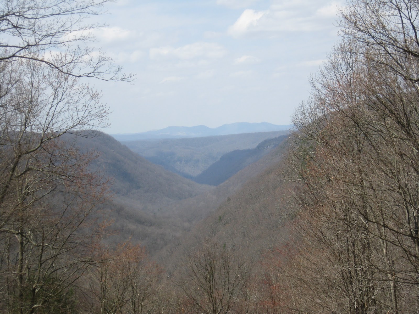
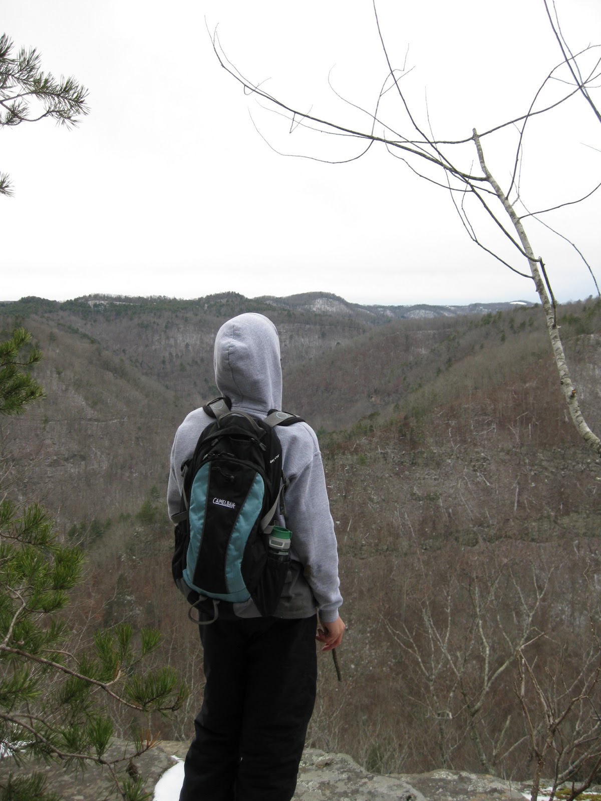
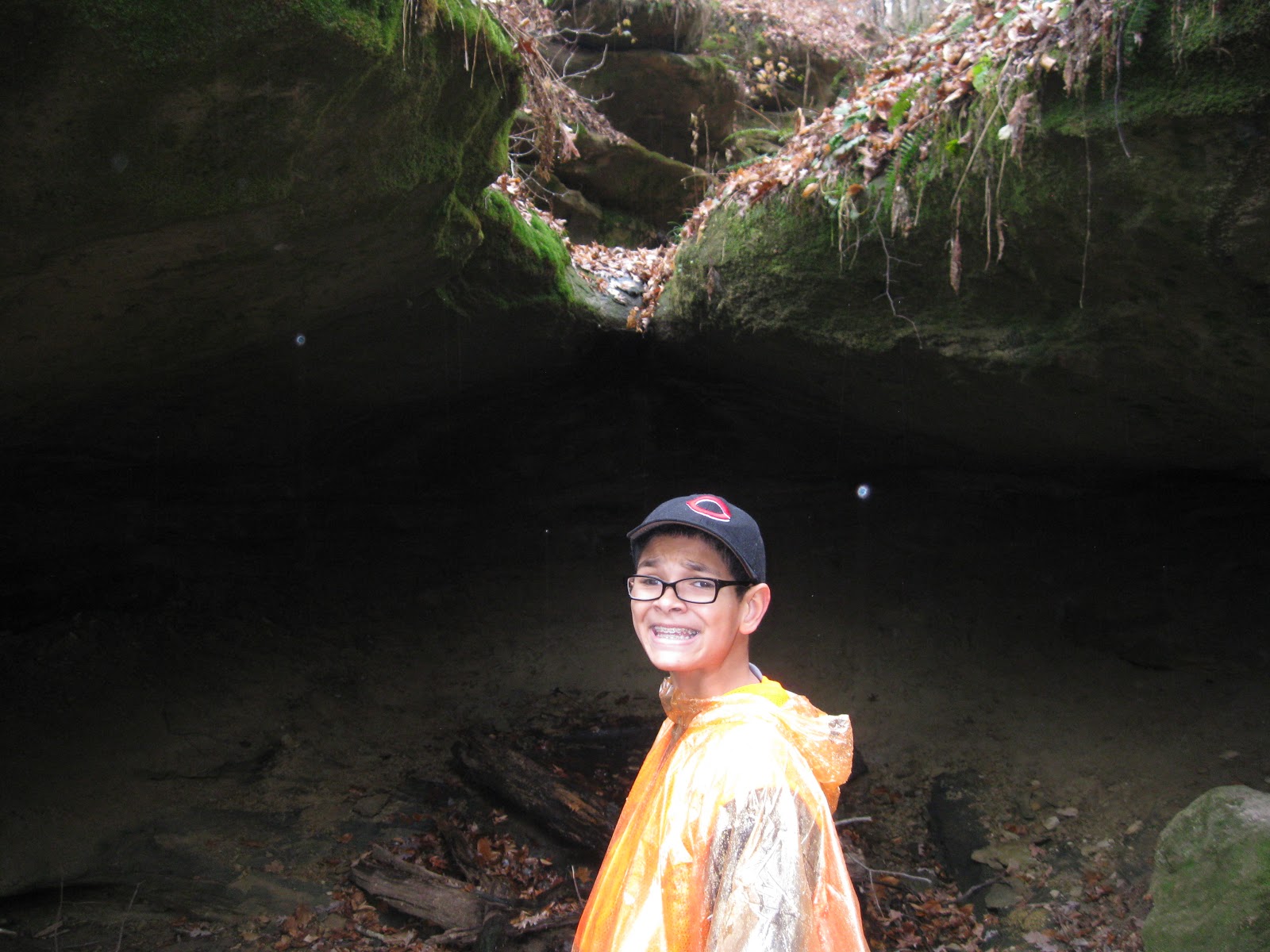
On April 14, Burt, Cool Guy, and I did the 1/2 mile Overhanging Rock Trail at North Bend SP.  We just needed 1/10 of a mile to get Cool Guy up to the 25 miles required to earn his walking stick from WV State Parks, so I wanted it to be as painless and easy as possible.

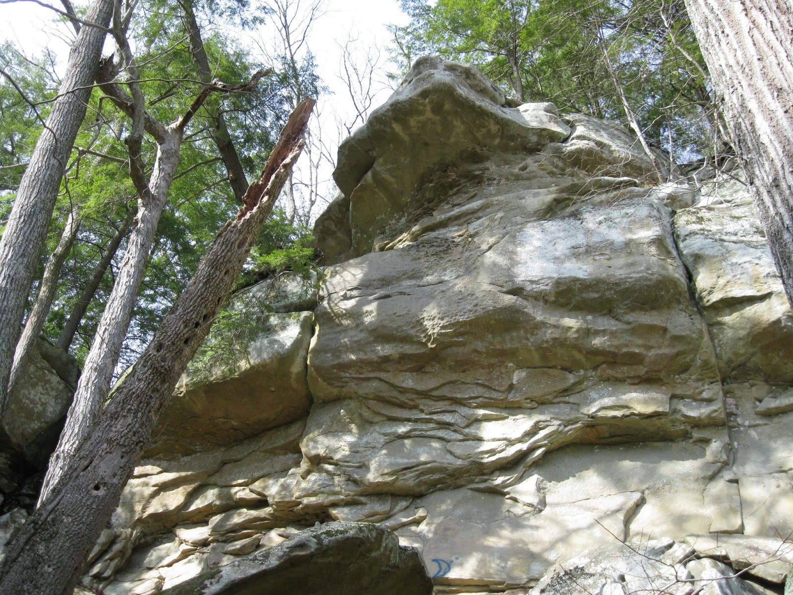
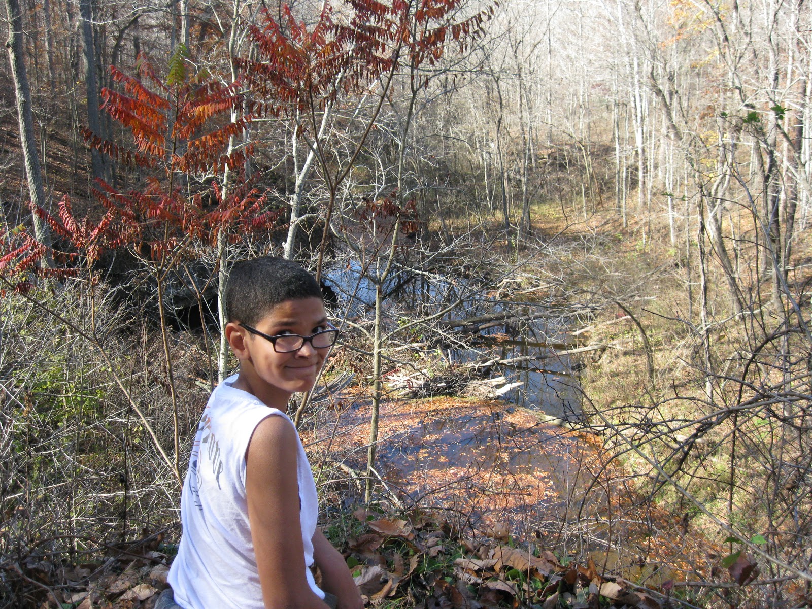
Now, Overhanging Rock is not an easy hike, but it is short, and there is a lot of bang for the buck.  We scrambled uphill and over and around some rocks until it leveled off.  Then down some very unstable stairs, the actual ones that Burt fell down last summer, and then we got to walk along the overhanging rock and the stream at the bottom.

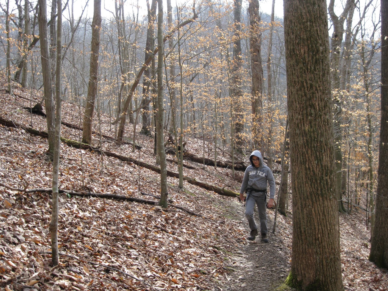
Differences between this time and last summer are that this time, there were some lovely wildflowers blooming, and there were a lot of trees down and a lot of obstruction in the pathways.  I was told by North Bend rangers that they clear out the paths twice a year, so I guess they haven't yet addressed it yet for the summer.

Another really COOL thing was that Burt found a critter skull in the pathway.  It has huge fang teeth, but it is a small, oblong skull.  Of course, we brought it home, stuck it in a bucket of bleach and are hoping to identify it soon.

The weather was fantastic.  Not too hot, not too cold.

Monday, April 29, 2013

Babcock SP

On April 9, Cool Guy and I took quite a long drive down to Babcock State Park.  This is one of my very favorite places.  We hiked the Skyline Trail.  It is 2 miles one way.

The weather was fantastic.  If anything, it was warmer than we would have liked.

The trail starts from a cabin area and immediately goes up at a gentle grade and into a stand of rhododendrons and a lovely down falling stream, like a baby waterfall.  For the upward part, we were surrounded by giant rhododendrons most of the way with some parts of hardwood.  There were some amazing overlooks once we got to the top and leveled off.  I need to add that we just didn't have to climb very high to get way above the world.

Another really cool thing is that for the entire hike, we could hear the water rushing in the river below us.  So we had it all: view, water, sound.

At the end of the trail, we were next to the road.  There was a picnic area and the most amazing view.  We enjoyed our lunch and gazed at the mountains.  We decided to hike back the way we came, but Cool Guy went much, much faster this time, and we made it to the bottom in 25 minutes.  I'm glad we took our time getting to the top and enjoying the scenery on the way up.


Wednesday, March 13, 2013

North Bend, March 2013

Cool Guy, Burt, and I went to North Bend SP on a fine, fine Sunday, March 10.  I think the high was around 70.  Yeah!

Our hike covered Overlook Trail, and we added part of Lake Trail onto that in order to take a good close look at the dam.  It seems that dams are invading all my hikes of late.

We took Overlook going clockwise.  First we went down, down, and at the bottom needed to cross a stream by hopping rocks, a task Cool Guy loved.  Then we walked through a pine plantation.  We saw lots of fallen trees, probably from winter storms, but the trail was clear and well-blazed.  We enjoyed listening to the trees creak in the breeze.  After going through the pines, we came to the dam overlook.  From there we left the Overlook Trail to follow Lake Trail so the guys could get right up to the dam and see it from the other side.  Cool Guy enjoyed that part, and Burt enjoyed explaining about dams.  I sat on a log in the shade because it had gotten mighty hot.

After admiring the dam, we got back onto Overlook, where we walked alongside the Hughes River for a bit, and then went inland among huge boulders.  Along the way we saw a trio working their way up a rock face. After passing the rock climbers, we went through a rock tunnel, and just saw more neat rock scenes than anywhere else.  Why does no one know about this fantastic hike?

After the rocks, it was up, up, up through deciduous woods until we arrived at our car.  Total distance for Overlook was 1.2 miles, and the Lake Trail bit was an extra mile added on.


Saturday, March 9, 2013

Tygart Lake SP

Today, Cool Guy and I planned on a return trip to Valley Falls SP, his favorite.  The plan was thwarted when we arrived and the gate was closed.  It was surprising.  I double checked my brochure and there was no mention of seasonal closing, no signs posted, nothing.  Well, we weren't going to have driven 2 hours for nothing, so we drove on over to Tygart Lake, which wasn't too far away.

The weather was at least 10 degrees cooler there than at home.  I had a hat and mittens and I needed them.  My heavy sweater was just right after we started hiking.

The lodge at the park was very nice, with the entire back side of it being windows overlooking the lake.  It was a lovely sight.  Someone working there was familiar enough with the trails to give us some guidance, which was much appreciated, as we were doing this on the fly.

We began with the Dogwood Trail which went straight up, up, up until we reached the ridge top.  The trail was well-blazed, but there was an incredible amount of trees and branches down, and it was pretty rough going in places.  At the ridge top, there was one open expanse which had a nice view of the valley beyond.  Then it was down, down, down, crossing rivulets of snow melt, scrambling over fallen trees, all the while enjoying our solitude outside in soft weather.

At the bottom of the hill, we crossed the park road and began the Dam Trail.  It was very level, but a lot mushier, being at a lower elevation.  Nonetheless, it was a pleasant hike with woods on one side and the lake on the other.  The trail terminated at the dam with an overlook of the lake and the dam and some benches where we could have our lunch.  Dams just don't thrill me.

Cool Guy went down to the lakeside after we had eaten and just messed around.  When he came back up, he was bothered by the amount of trash around the lake: old tires, beer bottles, paint cans, and the like.  To finish up the hike we doubled back on the dam trail and then went further on it, past the lodge until we reached our car again.  Cool Guy pointed out to me all the trash on the sides of the trail.

If Tygart doesn't have a clean up program, I hope one can be started.

Despite the trash, despite the change in plans, it was a good day, perhaps because it was a saved day after all.


Thursday, March 7, 2013

Hibbs Cemetery, North Bend SP


During a week in mid-February, I was at a quilt retreat at North Bend State Park.  Luckily, the weather allowed a little hiking in between snow storms.  On Feb. 18, one of my quilting buddies, Nanny, and I hiked the Hibbs Cemetery/Nature Trail loop.  Total distance was about 2 miles.  The day was the warmest of the week, nearing 50 degrees.

The Hibbs Cemetery Trail begins right behind the North Bend Lodge.  It immediately goes up and does a little up and down.  This wouldn't have been a problem except for two things: first the ground was pretty muddy and slippery, and second, there were a lot of trees, branches, etc. blocking the trail, making it necessary to do quite a bit of scrambling, and this on muddy, slippery ground.  However,  after the initial rough going, we reached the top of the ridge, and then the debris was not as bad.

We were rewarded with some fantastic rock formations, not to mention the peace of being outdoors in the the clean, clear air.  The trail was mostly through woods, and there wasn't any view to speak of, but this walk in the woods was lovely in its own way.

The trail, according to the map, goes by the cemetery of an early pioneer family in the area.  We reached the end of the trail and saw nothing.  Sure that we had just been too busy gabbing to notice, we turned around to look again.  About where we guessed it should be, sure enough there was the sign for the cemetery, but it was lying face down on the ground.  We propped it against a tree and searched in vain for headstones.  There were none.  Asking the ranger afterwards, we learned that there are no headstones, the cemetery is just that flat piece of ground. 

On the way back, we took a section of the Nature Trail and got to see new sights.  It ended at the road to the lodge, and as we were walking back, we saw some horsemen getting ready for a ride on the trail.

Tuesday, February 12, 2013

Kanawha State Forest, Overlook Rock Trail

Cool Guy and I went to Kanawha State Forest for the first time Feb. 7.  For a nice change, the weather was clear and warmish, after a couple of weeks of overcast skies, rain and snow.  I chose Overlook Rock Trail because it immediately involved climbing, and I figured that getting up might get us away from snow run-off.

Finding Kanawha State Forest was very easy.  I forget how easy it is to get around in Charleston.  After taking the correct exit, I only needed to follow the signs for 6 miles.  Easy peasy.

Once we got to the forest, I checked in at the station to get our VIPP cards stamped, and the ranger was very helpful to us, recommending the best way to hike the Overlook Rock loop.  We began with the hard climbing and then at the end of the hike, we got our reward in the form of a fantastic view on a large rock.

But I'll start from the beginning.  The trail was extremely well-blazed, and the trail, though narrow, was clear and easy to follow, even with leaves all over the ground.  We began by going up, up, up, though none of it involved scrambling over anything.  Just steady upward movement.  Finally at the ridge top, we had pretty level walking.  At the top, it was evident that the forest suffered quite a bit from the storm damage of last summer.  There were trees down everywhere, though none obscuring or blocking the trail.  One thing I noticed at ridge top was that thorn brambles grew thick right to the edge of the trail.  I imagine that they only get worse as the spring and summer come along, so I was glad that we were hiking this one in winter.

There were so many beautiful sights: large moss-covered rocks, little streams babbling, trees, views.  And then we came to the rock.  It was huge and gave us the most fantastic view of the hills and valleys all around.  It was hard to believe that we were in Charleston.

After having our lunch on the rock, we trekked on, almost immediately heading down.  The hike down was easy, not too steep at all.  One interesting part was that when we got to the bottom, our trail took us right up next to a stream, and with the snow melt, often the stream was in the path.  We crossed back and forth over it a few times.  We saw a few small waterfalls tumbling over rocks.  I don't know, but I'm guessing that in drier weather, these little runs are missing.

This was a short hike, on 1.5 miles, but it had everything: climb, view, water interest.

We were the only ones there.  It was so quiet and peaceful.  Definitely going again.


Saturday, January 19, 2013

Lamping Homestead Trail, Wayne National Forest

Saturday, Jan. 19 2013
Temp.: mid to upper 40's

Cool Guy and I hiked the 4 mile Lamping Homestead Trail at Wayne National Forest, Marietta Branch, today.  Looking at the map, I thought this was going to be quick and easy.  As usual, I was wrong.  Although the turnoff for the park was only 35 miles outside Marietta OH, it was 35 miles of winding road, and it took an hour to drive that 35 miles.  One notable thing was that we never met another car on the way there.  We did see two tractors, two hunters in a field, and three covered bridges, but no other cars.

When we arrived at the park, ours was the only car in the lot.  At that point, I thought it might be smart to text Burt and let him know where we were and that I would text him again when we finished.  That would have been a great plan if I had thought to do this before we started, but as it was, there was no internet, so we were alone and on our own.  Note to self: always let someone know where you're going BEFORE you get there.  Luckily, there were no problems and no need for the text, but one never knows.

The day was sunny, windy, and warmish.  I had on my heavy wool sweater, and it was great, except when it was too warm.  But the great thing about this hike was that it changed every 10 minutes or so.  We might be on a sunny stretch one minute, and then in a pine plantation the next.  The sweater was definitely appreciated.

After the first mile, we were given the opportunity to take the short loop and cut the hike to 1.8 miles.  Cool Guy was for that option, but I pointed out to him that the path wasn't muddy, the day was nice, and I would prefer that our hike take longer than our drive to get to it.  So we soldiered on the long loop, and I'm so glad we did.

We walked through one pine plantation during a strong bout of wind, and it was so cool to hear the trees creaking in the wind.  At first, I thought it was a bird shrieking, that is how it sounded.

The trail itself was varied.  We walked through meadows, on pine needles, leaves, jumped streams, crossed creeks, worked our way up slanted ridges, never level, and toward the end, slogged through and dodged around mud and ice.  Never a dull moment.

One moment on a ridge top gave us a nice vista, but for the most part, it was a woods walk.  I would definitely like to do this again in the summer because I think it would be a nice, shady hike.

The trail was well-marked, but even so, we strayed off the trail a time or two.  For me, an ideal trail would have every darn tree with a blaze.  Otherwise, I am going to miss the path somewhere, somehow.  But if we went too long without seeing a blaze, we would backtrack and find our way again.

I am proud of Cool Guy for doing the 4 miles without complaining.  For him, it's all about being done, though he enjoys it, he most likes knowing where the end is.  I'm sure it helped that we were very comfortable throughout, and though the trail was difficult in some places, there wasn't that much up and down.  It was mostly level, though uneven, hiking.

The hike ended with us going around an Indian Burial mound, something that really impressed Cool Guy.

Definitely going again, and next time allowing time to check out the covered bridges.


Thursday, January 3, 2013

Canyon Rim Trail, Pipestem SP

After almost two solid months of hiking frustration, (hunting, rain, illness), the family finally got to make up for some lost time with our end of the year vacation to Pipestem SP.  As a family, we did one amazing hike.  I did two others, which I will post about later.  Our family hike was Canyon Rim Trail, and it was the best of the bunch.

We did this hike on New Year's Eve, Jan. 31, 2012.  There was a little snow on the ground, and the temperature was in the upper 30's or lower 40's, so the snow wouldn't last long.  Surprisingly, even Encyclopedia wanted to go along.

The trail is .7 mile one way and ends at a rock outcropping overlooking the Bluestone River Canyon.  The trail began downhill and continued that way the entire way to the rim of the canyon.  For us older folks, that was the hard part, going down on a steep, sometimes slippery path.  I think Burt wished at times that he had brought his walking stick.

At the end of the trail, we were on two major rock outcrops and had the most wonderful view of the valley, with the very, very blue Bluestone River at the bottom.  The sky was clear, no one was anywhere near, and it was so peaceful.

I'm glad that the beginning of the trip was downhill because I don't know if I could have gotten the boys to go all the way if we had had the climb at the outset.  As it was, the uphill to get back was strenuous.  Cool Guy needed some encouragement and coaching on just going a little more slowly, thus not needing to stop as often.  He did well.

I would definitely do this hike again, especially in the fall in order to see the leave from that viewpoint.


Thursday, November 29, 2012

Overhanging Rock Trail, North Bend SP

Another catch-up post.  North Bend State Park is our "local" state park.

Here is my journal entry:

Overhanging Rock
North Bend State Park
August 2012

Encyclopedia, Cool Guy, Burt, and me

Drizzy day.  Lovely 1/2 mile hike involving some climbing and stairs down a steep slope.  Walk along rocks neat.

Burt fell down the stairs.

That's it.  That's the whole entry.  What I remember is that we had lunch first, and then right as we were about to hike, this amazing storm just blew in out of nowhere.  We were in a picnic shelter and decided to give it a few minutes, and pretty soon, the storm passed.  It was pretty neat seeing it come in.

I also remember that everyone, including Encyclopedia, who claims not to like hiking but secretly does, had a wonderful time.

And that bit about the stairs: remember, it had been raining.  The stairs were wood, and wet, and unlike in Ohio parks, there was no chicken wire over the treads.  Burt fell and fell hard.  And it hurt.  Bad.  You should have seen the bruise.  And the stigmata on his palm.  Now, every time we encounter wooden stairs on a trail, we have to make some joking reference to Burt.  That's what is so great about family: the accumulated experiences and inside jokes that arise from them.  North Bend will always be the place of The Fall.

Burt got some decent boots after the fact.

Crabtree Falls

Since there was no hiking last week ( and the weather was glorious!) due to the opening of buck season and the entire male half of WV out there with guns, and also since my trip for this week got rained out, I've decided to fill in when there are gaps with some hikes that we've done before the blog was begun.  There aren't that many, but they will be out of order from the rest.

The first was my first hiking trip since Burt and I used to hike in the Olympics, over 20 years ago.  My very dear friend, Hilly Holly, arranged to meet me in Waynesboro, Virginia for a few days of hiking, touristing, tennis, and catching up after too many years apart.  She is an avid hiker, and I owe a huge thanks to her for getting me and my family involved in this great adventure.

HH researched the hiking possibilities carefully ahead of time and sent me several to choose from, Crabtree Falls being the winner. My main impressions were that we got off to a late start hiking, due to fuzzy directions from the website, and it was an incredibly hot day.  We didn't begin until 11:00, and we experienced the heat.  I still loved it.  Other vivid remembrances were that I was wearing Encyclopedia's Combat boots since I did not have a pair of hiking boots.  They ALMOST fit perfectly, but that little "almost" resulted in major blisters and pain, so I wisely switched to my running shoes, which I had packed just in case.  And finally, even though I walk the dog about 4 miles every day at a pretty brisk pace, I quickly learned that walking shape is not the same as hiking shape, especially when a mountain is involved.

All of that sounds very negative, and yet, I totally loved it and wondered why in the world it had taken me so long to get back to this.  I took notes in my journal, which I will copy down here.

Crabtree Falls
July 26, 2012
George Washington National Forest

My first hike.  Hiked with HH.  We got lost getting there and didn't get started until 11:00.  Hiked 1.5 miles to the summit, where we lunched with the most glorious view.  Nine switchbacks, lots of stairs, and view of the waterfall in its entirety.

HOT.  105 degree heat index.


That's it.  First hike.  Loved it.

Monday, November 12, 2012

Hope Lake SP, Old Hollow Trail

Cool Guy was off school today for Veterans' Day, so we had a hike planned.  Forecast called for rain later in the afternoon.  No problem.  We set off early and didn't have too far to travel.  Skies were clear.

Our destination was Lake Hope SP, west of Athens OH, and south of Nelsonville OH.  The plan was to start at the Hope Furnace, a very old iron smelting furnace used to make munitions for the Union during the Civil War, hike the Peninsula Trail around Lake Hope and then do a second loop of Old Hollow Trail to get the gorge, caves and waterfall.  That was the plan.

The actuality was that AS SOON AS we put our hiking boots on and donned our orange vests, just in case, though hunting is not permitted, it started to rain.  This, at 9:30 am., not the projected 3:00 pm.  Well, just a few raindrops.  We had hats, and we had rain ponchos, so we put those on, quickly checked out the furnace and decided to do the Old Hollow first because it was short, hope that the rain would stop and then complete things with the Peninsula.

It didn't stop.  It never became a miserable downpour, but it became steady enough that we definitely felt we were hiking through rain, and I never saw Cool Guy so focused on moving forward, making tracks, gaining ground.

Despite the less than perfect conditions, it was a wonderful hike.  The loop was only 1 1/2 miles, but it was an interesting hike with lots of changes and interest.  The trail was easy in that it was very well marked with blue blazes and clear signs.  It was not so easy in its footing.  Hiking through it wet added to the difficulty because there was a lot of up and down, a lot of wooden steps with nothing on them for traction, many steep, some with missing steps.  There were a few fallen trees to scramble over, and one area of the trail was basically water seepage where we had to pick our way through the best we could.

Highlights of the trail included an old pioneer cemetery with engraved sandstone markers, some covered with moss.  Also, at the bottom of the gorge was where a waterfall should have been, but it wasn't wet enough yet, and next to the waterfall place was a really cool rock overhang so deep that it could almost be called a cave.  The whole thing was very lovely.

Another interesting thing about this hike was that we came upon several backpackers, the real kind with great big packs on their backs.  All were headed out.  They had been hiking the Zaliski Trail which shares a bit with Old Hollow.  We saw two men, and then later, two women and a German Shepherd, and at the end, we were being followed by a Boy Scout troop.  I'm assuming that at the start of the rain, the backpackers packed up and headed out.

Also of interest was a beaver dam which we saw at the beginning and end of the loop.  I have never seen one before, but I knew right off that this is what it was.  Pretty neat.

Cool Guy can't wait to go back and bring Burt and Encyclopedia.  It was just a little over an hour's drive, and there is a whole lot of different hiking to do, so we will definitely return.


Friday, October 26, 2012

Fort Hill Memorial

No school on October 25, and the forecast was sunny and 80.  We were headed out.  Poring through the Falcon Guide, Hiking Ohio, I decided that Fort Hill was a good destination for an all-day adventure.  It WAS a day of adventure and some lessons learned.

I had slightly underestimated the drive there.  It was 2 hours on Hwy. 32 before we got to the turnoff at Peebles Ohio.  Good thing we had gotten an early start.  Once on 41, it was definitely rural farm country.  In fact, a chicken crossed the road in front of me.  I asked why. :-)

Fort Hill was easy to find, with loads of parking, a museum which was closed on weekdays, lots of picnic shelters, and we were the only ones there.  Lovely.  According to the website, we could pick up trail maps there, but although there was a box for them at the trailhead kiosk, the box was empty.  I had copied the pages from my book, which included a sketchy map, and we forged ahead.

We took the Gorge Trail and picked up the Fort Trail to end the hike.  Total distance was 4 miles.  The website warned that the trails were primitive, though I would say that they were fine and easy to see, just not wide and well-groomed.  The book also mentioned a lot of up and down, and looking back, I'd say we did spend most of our time going either up or down.

It was incredibly beautiful.  The leaves were about 75% fallen and what was left was gorgeous.  The Gorge trail followed along a stream most of the way, and it seemed like every 5 minutes there was a new and different scene: either a view of the crystal clear stream below, or an outlook over the area, or deep in various stands of trees, or walking among overhanging rocks.  It just couldn't get monotonous.  At one point, the trail even took us THROUGH a log cabin.  Finally, I said that we just had to stop taking pictures or we'd still be around at dark.

We stopped for our picnic on a moss-covered outcropped overlook, which was about the halfway point.

Things got a little confusing at the point where we were supposed to pick up the Fort Trail.  Our guide just said there'd be a sign.  Unfortunately, there wasn't, but there were other signs and quite a few intersections to choose from.  That is where the trail map would have come in very handy, and lesson learned is to download and print one out beforehand.  This caused Cool Guy some anxiety because by this time, he was very tired.  But as we were resting on a log, two other hikers came by and assured us we were on the Fort Trail and headed to the end of the hike.  Whew!

The Fort Trail was much easier, with a gentle but steady incline up one side of an ancient Indian mound and then back down.  It was strictly through hardwoods and we shuffled through ankle deep leaves and scrambled over, under, and around giant fallen trees across the path.  At one point, we surprised a flock of turkey buzzards.


Total time hiking was 4 hours, and as soon as we headed back home, Cool Guy fell asleep.  It was definitely worth the drive.