No school on October 25, and the forecast was sunny and 80. We were headed out. Poring through the Falcon Guide, Hiking Ohio, I decided that Fort Hill was a good destination for an all-day adventure. It WAS a day of adventure and some lessons learned.
I had slightly underestimated the drive there. It was 2 hours on Hwy. 32 before we got to the turnoff at Peebles Ohio. Good thing we had gotten an early start. Once on 41, it was definitely rural farm country. In fact, a chicken crossed the road in front of me. I asked why. :-)
Fort Hill was easy to find, with loads of parking, a museum which was closed on weekdays, lots of picnic shelters, and we were the only ones there. Lovely. According to the website, we could pick up trail maps there, but although there was a box for them at the trailhead kiosk, the box was empty. I had copied the pages from my book, which included a sketchy map, and we forged ahead.
We took the Gorge Trail and picked up the Fort Trail to end the hike. Total distance was 4 miles. The website warned that the trails were primitive, though I would say that they were fine and easy to see, just not wide and well-groomed. The book also mentioned a lot of up and down, and looking back, I'd say we did spend most of our time going either up or down.
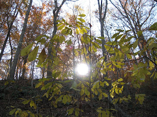
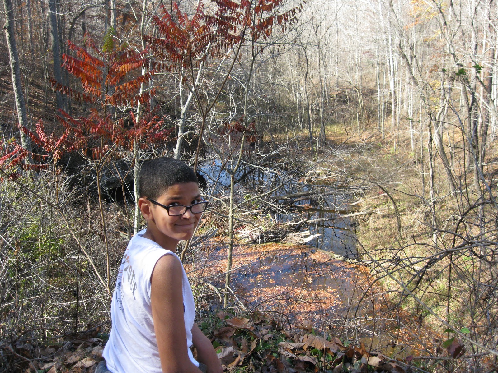
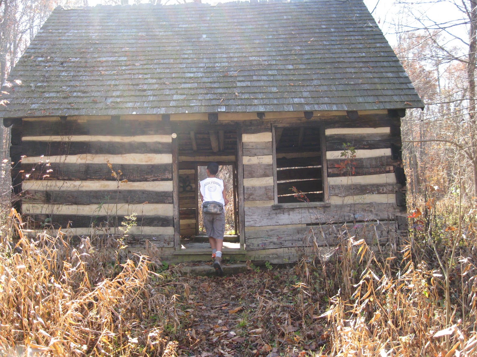
It was incredibly beautiful. The leaves were about 75% fallen and what was left was gorgeous. The Gorge trail followed along a stream most of the way, and it seemed like every 5 minutes there was a new and different scene: either a view of the crystal clear stream below, or an outlook over the area, or deep in various stands of trees, or walking among overhanging rocks. It just couldn't get monotonous. At one point, the trail even took us THROUGH a log cabin. Finally, I said that we just had to stop taking pictures or we'd still be around at dark.
We stopped for our picnic on a moss-covered outcropped overlook, which was about the halfway point.
Things got a little confusing at the point where we were supposed to pick up the Fort Trail. Our guide just said there'd be a sign. Unfortunately, there wasn't, but there were other signs and quite a few intersections to choose from. That is where the trail map would have come in very handy, and lesson learned is to download and print one out beforehand. This caused Cool Guy some anxiety because by this time, he was very tired. But as we were resting on a log, two other hikers came by and assured us we were on the Fort Trail and headed to the end of the hike. Whew!
The Fort Trail was much easier, with a gentle but steady incline up one side of an ancient Indian mound and then back down. It was strictly through hardwoods and we shuffled through ankle deep leaves and scrambled over, under, and around giant fallen trees across the path. At one point, we surprised a flock of turkey buzzards.


 Total time hiking was 4 hours, and as soon as we headed back home, Cool Guy fell asleep. It was definitely worth the drive.
I had slightly underestimated the drive there. It was 2 hours on Hwy. 32 before we got to the turnoff at Peebles Ohio. Good thing we had gotten an early start. Once on 41, it was definitely rural farm country. In fact, a chicken crossed the road in front of me. I asked why. :-)
Fort Hill was easy to find, with loads of parking, a museum which was closed on weekdays, lots of picnic shelters, and we were the only ones there. Lovely. According to the website, we could pick up trail maps there, but although there was a box for them at the trailhead kiosk, the box was empty. I had copied the pages from my book, which included a sketchy map, and we forged ahead.
We took the Gorge Trail and picked up the Fort Trail to end the hike. Total distance was 4 miles. The website warned that the trails were primitive, though I would say that they were fine and easy to see, just not wide and well-groomed. The book also mentioned a lot of up and down, and looking back, I'd say we did spend most of our time going either up or down.
It was incredibly beautiful. The leaves were about 75% fallen and what was left was gorgeous. The Gorge trail followed along a stream most of the way, and it seemed like every 5 minutes there was a new and different scene: either a view of the crystal clear stream below, or an outlook over the area, or deep in various stands of trees, or walking among overhanging rocks. It just couldn't get monotonous. At one point, the trail even took us THROUGH a log cabin. Finally, I said that we just had to stop taking pictures or we'd still be around at dark.
We stopped for our picnic on a moss-covered outcropped overlook, which was about the halfway point.
Things got a little confusing at the point where we were supposed to pick up the Fort Trail. Our guide just said there'd be a sign. Unfortunately, there wasn't, but there were other signs and quite a few intersections to choose from. That is where the trail map would have come in very handy, and lesson learned is to download and print one out beforehand. This caused Cool Guy some anxiety because by this time, he was very tired. But as we were resting on a log, two other hikers came by and assured us we were on the Fort Trail and headed to the end of the hike. Whew!
The Fort Trail was much easier, with a gentle but steady incline up one side of an ancient Indian mound and then back down. It was strictly through hardwoods and we shuffled through ankle deep leaves and scrambled over, under, and around giant fallen trees across the path. At one point, we surprised a flock of turkey buzzards.


No comments:
Post a Comment