Showing posts with label River. Show all posts

Monday, April 29, 2013

Babcock SP

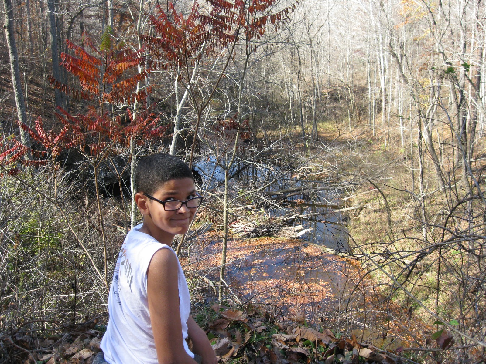
On April 9, Cool Guy and I took quite a long drive down to Babcock State Park.  This is one of my very favorite places.  We hiked the Skyline Trail.  It is 2 miles one way.

The weather was fantastic.  If anything, it was warmer than we would have liked.

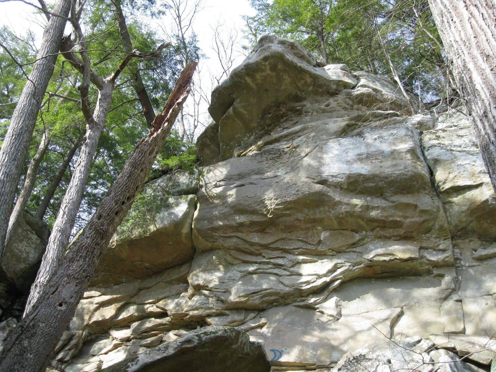
The trail starts from a cabin area and immediately goes up at a gentle grade and into a stand of rhododendrons and a lovely down falling stream, like a baby waterfall.  For the upward part, we were surrounded by giant rhododendrons most of the way with some parts of hardwood.  There were some amazing overlooks once we got to the top and leveled off.  I need to add that we just didn't have to climb very high to get way above the world.

Another really cool thing is that for the entire hike, we could hear the water rushing in the river below us.  So we had it all: view, water, sound.

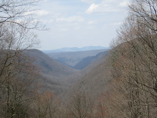
At the end of the trail, we were next to the road.  There was a picnic area and the most amazing view.  We enjoyed our lunch and gazed at the mountains.  We decided to hike back the way we came, but Cool Guy went much, much faster this time, and we made it to the bottom in 25 minutes.  I'm glad we took our time getting to the top and enjoying the scenery on the way up.


Wednesday, March 13, 2013

North Bend, March 2013

Cool Guy, Burt, and I went to North Bend SP on a fine, fine Sunday, March 10.  I think the high was around 70.  Yeah!

Our hike covered Overlook Trail, and we added part of Lake Trail onto that in order to take a good close look at the dam.  It seems that dams are invading all my hikes of late.

We took Overlook going clockwise.  First we went down, down, and at the bottom needed to cross a stream by hopping rocks, a task Cool Guy loved.  Then we walked through a pine plantation.  We saw lots of fallen trees, probably from winter storms, but the trail was clear and well-blazed.  We enjoyed listening to the trees creak in the breeze.  After going through the pines, we came to the dam overlook.  From there we left the Overlook Trail to follow Lake Trail so the guys could get right up to the dam and see it from the other side.  Cool Guy enjoyed that part, and Burt enjoyed explaining about dams.  I sat on a log in the shade because it had gotten mighty hot.

After admiring the dam, we got back onto Overlook, where we walked alongside the Hughes River for a bit, and then went inland among huge boulders.  Along the way we saw a trio working their way up a rock face. After passing the rock climbers, we went through a rock tunnel, and just saw more neat rock scenes than anywhere else.  Why does no one know about this fantastic hike?

After the rocks, it was up, up, up through deciduous woods until we arrived at our car.  Total distance for Overlook was 1.2 miles, and the Lake Trail bit was an extra mile added on.


Saturday, March 9, 2013

Tygart Lake SP

Today, Cool Guy and I planned on a return trip to Valley Falls SP, his favorite.  The plan was thwarted when we arrived and the gate was closed.  It was surprising.  I double checked my brochure and there was no mention of seasonal closing, no signs posted, nothing.  Well, we weren't going to have driven 2 hours for nothing, so we drove on over to Tygart Lake, which wasn't too far away.

The weather was at least 10 degrees cooler there than at home.  I had a hat and mittens and I needed them.  My heavy sweater was just right after we started hiking.

The lodge at the park was very nice, with the entire back side of it being windows overlooking the lake.  It was a lovely sight.  Someone working there was familiar enough with the trails to give us some guidance, which was much appreciated, as we were doing this on the fly.

We began with the Dogwood Trail which went straight up, up, up until we reached the ridge top.  The trail was well-blazed, but there was an incredible amount of trees and branches down, and it was pretty rough going in places.  At the ridge top, there was one open expanse which had a nice view of the valley beyond.  Then it was down, down, down, crossing rivulets of snow melt, scrambling over fallen trees, all the while enjoying our solitude outside in soft weather.

At the bottom of the hill, we crossed the park road and began the Dam Trail.  It was very level, but a lot mushier, being at a lower elevation.  Nonetheless, it was a pleasant hike with woods on one side and the lake on the other.  The trail terminated at the dam with an overlook of the lake and the dam and some benches where we could have our lunch.  Dams just don't thrill me.

Cool Guy went down to the lakeside after we had eaten and just messed around.  When he came back up, he was bothered by the amount of trash around the lake: old tires, beer bottles, paint cans, and the like.  To finish up the hike we doubled back on the dam trail and then went further on it, past the lodge until we reached our car again.  Cool Guy pointed out to me all the trash on the sides of the trail.

If Tygart doesn't have a clean up program, I hope one can be started.

Despite the trash, despite the change in plans, it was a good day, perhaps because it was a saved day after all.


Thursday, March 7, 2013

Overlook Trail, North Bend SP

While at quilt retreat, I was fortunate enough to go on two hikes.  The second, done on Feb. 21, was the Overlook Trail.  We - Nanny, Charlie, Becky, and I - had to drive in Becky's new truck to the cabins to begin our hike.  It was cold out there, but the sun was shining.  It was definitely worth the time and trouble.

Overlook began with a descent and wound through woods, but round a corner, there would be a fantastic rock formation, or a view.  The point of this trail was to wind in and out around the Hughes River and finally to reach an overlook of the dam.  The hike and the river were fantastic, but the dam was just a dam.

In general, the trail was well-blazed, except around the dam area.  If it weren't for Becky and her amazing sense of direction, we might still be wandering around trying to find our way out.  Going out, we hiked through more woods, crossed a stream, and in general just had the nicest of times.  I plan on taking the family there soon.


Sunday, November 11, 2012

Ohio River Islands, Nov. 10

Burt, Cool Guy, and I decided to do a very local hike for this weekend.  We had a lot going on and didn't really have the time to put in a lot of driving.  We chose Ohio River Islands National Wildlife Refuge because  we had never hiked the Upper Trail, which is across the road from the headquarters building.  That trail is on a hill in the woods as opposed to being on the flat floodplain.

What we didn't realize is that beginning Nov. 10, yes, Nov. 10, the very day that we were there, the Upper Trail was closed to hikers until Jan. 1 2013 because of bow hunting season.  Sigh.  It is time to break out the orange vests and chose hikes carefully.  Now, I am not opposed to hunting, and I hope those bow-hunters get lots and LOTS of deer, as we have way too many, but I just wish it didn't interfere with my plans.  Oh well.  It's a very little thing.

So we went to Plan B, which was hiking the Bird and Butterfly Trail, and the River Trail.  It was a fantastic day. The sun was shining, and we were thankful for the breeze because otherwise we would have been too hot in the layers we were wearing.

There were still grasshoppers on the edges of the trails, which surprised us, as we have already had more than one killer frost.  Another thing of note was this wonderful fragrance somewhere among the plants.  There was first a smell like one gets in a craft store full of the dried flowers that usually makes me sneeze.  And then there was another, spicier scent, which, when I asked at the headquarters, I learned was probably Spice Bush.  I'd like to go back and identify it positively sometime.

Also of note was the the path which runs right along the river's edge was completely washed out, as in covered deeply in mud.  There was a line of muddied debris right beyond where the path should have been.  This puzzled us because we couldn't think what would have caused this to happen.  Hurricane Sandy did not get this far inland, and we escaped the Frankenstorm.  All we had was a week of steady rain, but it was just rain, not wind or downpours.  I asked at headquarters and was told that the bottom trail is really just the first tier for the river to expand if it floods, and apparently, a week of rain and a storm elsewhere is enough to cause "flooding."  I'm saying it's not really flooding, just rising a little but still very much within bounds.

Other points of interest on this very short Plan B hike were surprising a dule of dove (that is the group name for dove; I looked it up), finding a bat house on an old dead tree, and finding the most interest tree that grew into a huge arch.  I wonder what caused it to do that.  It may have been that something else was in its way, so it had to grow that way, or there may be another explanation.  I will have to ask the ranger next time.

Total distance of this very easy hike was probably 1 mile.  We finished with lunch at Blacksmith Barbeque, our favorite place to eat and just across the river.  Enjoyed ourselves and learned a thing or two.


Saturday, November 3, 2012

Audra State Park

Today, Cool Guy and I traveled two hours to Audra State Park, near Buckhannon WV.  Burt warned me ahead of time that there might be snow, due to the Frankenstorm resulting from Hurricane Sandy colliding with a huge winter front.  We saw on Weather Channel that this had greatly affected the Snowshoe area, but I figured that Audra was far enough away from Snowshoe that it would have minimal impact.  My mistake was complacency due to my own area not being affected and lack of follow up by the media which focused instead on the aftermath of Sandy in the Northeast.

Lesson learned: check ahead of time if weather just might be an issue.  Why am I always learning lessons the hard way?

The drive down there was easy with no mishaps, but it was like an invisible wall.  As soon as we were about 10 miles away from Audra, suddenly there was snow.  First a little on the mountains, then snow covering all the ground.  But we're talking inches, not feet.  I wasn't worried.

What I wasn't aware of was that there was WIND to go with that snow in the Frankenstorm.  Having suffered greatly last July from a freak wind storm, losing power for 5 days of extreme heat, lines down, trees down everywhere, no water, no ice, I know what a major storm can do.  When we got to Audra, it looked pretty bleak.  Suffice it say, we were definitely the only ones there.  Snow was everywhere.  But trees were down everywhere, too.  What I had expected to be an easy hike turned out to be impossible to do if I wanted to do it safely.  Power lines lay across trees, which blocked trails.

Cool Guy and I wandered around a bit, looked at the damage, admired the incredibly beautiful Middle Fork River, and speculated what a future hike here will entail.  We are definitely going back, but giving the Rangers at least a month to get things back to normal.

We will definitely call ahead.


Total distance: probably 1 mile.  Difficulty: hard.  Couldn't walk 5 feet without navigating over, under, or around a tree.

Friday, October 26, 2012

Fort Hill Memorial

No school on October 25, and the forecast was sunny and 80.  We were headed out.  Poring through the Falcon Guide, Hiking Ohio, I decided that Fort Hill was a good destination for an all-day adventure.  It WAS a day of adventure and some lessons learned.

I had slightly underestimated the drive there.  It was 2 hours on Hwy. 32 before we got to the turnoff at Peebles Ohio.  Good thing we had gotten an early start.  Once on 41, it was definitely rural farm country.  In fact, a chicken crossed the road in front of me.  I asked why. :-)

Fort Hill was easy to find, with loads of parking, a museum which was closed on weekdays, lots of picnic shelters, and we were the only ones there.  Lovely.  According to the website, we could pick up trail maps there, but although there was a box for them at the trailhead kiosk, the box was empty.  I had copied the pages from my book, which included a sketchy map, and we forged ahead.

We took the Gorge Trail and picked up the Fort Trail to end the hike.  Total distance was 4 miles.  The website warned that the trails were primitive, though I would say that they were fine and easy to see, just not wide and well-groomed.  The book also mentioned a lot of up and down, and looking back, I'd say we did spend most of our time going either up or down.

It was incredibly beautiful.  The leaves were about 75% fallen and what was left was gorgeous.  The Gorge trail followed along a stream most of the way, and it seemed like every 5 minutes there was a new and different scene: either a view of the crystal clear stream below, or an outlook over the area, or deep in various stands of trees, or walking among overhanging rocks.  It just couldn't get monotonous.  At one point, the trail even took us THROUGH a log cabin.  Finally, I said that we just had to stop taking pictures or we'd still be around at dark.

We stopped for our picnic on a moss-covered outcropped overlook, which was about the halfway point.

Things got a little confusing at the point where we were supposed to pick up the Fort Trail.  Our guide just said there'd be a sign.  Unfortunately, there wasn't, but there were other signs and quite a few intersections to choose from.  That is where the trail map would have come in very handy, and lesson learned is to download and print one out beforehand.  This caused Cool Guy some anxiety because by this time, he was very tired.  But as we were resting on a log, two other hikers came by and assured us we were on the Fort Trail and headed to the end of the hike.  Whew!

The Fort Trail was much easier, with a gentle but steady incline up one side of an ancient Indian mound and then back down.  It was strictly through hardwoods and we shuffled through ankle deep leaves and scrambled over, under, and around giant fallen trees across the path.  At one point, we surprised a flock of turkey buzzards.


Total time hiking was 4 hours, and as soon as we headed back home, Cool Guy fell asleep.  It was definitely worth the drive.