Tuesday, April 2, 2013

Giant Pine Trail, North Bend SP

Yesterday, Cool Guy and I went to North Bend State Park in order to hike the Giant Pine Trail.  It is a short loop, only .6 mile, so we decided beforehand to hike it in one direction and then go back in the other.

The day was crisp, in the 30's, but it was a fair day, as in not slushy and not raining.

We took a little pal with us, Scamp, our Australian Shepherd.  Scamp had never been on a hike with us.  After yesterday's experience, I'd say he deserves to go again, depending on the trail and the distance involved.  Scamp could handle anything, but I don't think I can handle nonstop barking in my ear on the way there.  A huge benefit of Scamp is that he makes Cool Guy a much better hiker.  I don't have to prod CG along up the inclines because Scamp drags him along.

The loop begins right across from the lodge.  Lots of parking and very easy to find.  The trail is very well-marked with a yellow blaze, and the trail is easy to follow.  At the beginning of the hike, there were a lot of downed trees, and I was afraid that the hike would be one long, continuous view of what had been before The Storm of last summer.  Luckily, that was only the beginning part.

We immediately began going downhill and switched back and forth and a mostly moderate grade until we reached the bottom, where we crossed a stream, went a little further downhill, met a larger stream, and then lost sight of all blazes.  It was not well marked at this major turning point, but we got lucky and found our path again with a sharp turn at the bottom of the valley and then began the climb uphill.

The climbs were steep, but not overly so, and never of any duration.  We saw some underground springs where some trees had uprooted, lots of evidence of woodpeckers, a pine plantation, and lots of new sights.  Scamp sniffed something out that he got pretty excited about, but we persuaded him to keep going.

As soon as we got back to the car, it began lightly spitting rain, and by the time we got home, it was snowing and has kept at it ever since.  We seldom get the great good luck regarding weather, so I was thankful for this break.

Would definitely do this hike again, although there are others at North Bend that I like better.  But for a short hike with lots of woods, something that might be welcome in the summer, this one's a keeper.

Boord Nature Preserve

This is a belated post about the last hike Cool Guy and I took in February.  On the 25th, we went to Boord Nature Preserve, which is between Barlow and Bartlett OH.  I have never heard anyone mention this place before, and I only found it because I was searching around on the internet and just came across it.  It is amazing to me sometimes what neat stuff is so near.

Being a nature preserve, we have to follow special rules, like no wandering off the path at all and no taking anything, not that we do anyway.

The trail for the preserve is only .75 miles.  Cool Guy and I have done this hike twice, and we agree that it is best to make it worth the drive and do twice, once in each direction.  It's amazing what you can see going the other way.

On this day, the sky was sunny, and the air was crisp.  When we arrived, about 10:30, there was still frost on the grass to begin the hike.  It is interesting that once we got under tree cover, there was no frost on the ground, which makes me wonder if the tree cover is also frost protection.

There was very little up or down, but that little bitty loop gave us so much.  We hiked through a pine plantation, through deciduous woods and the highlight, the waterfall and pool, which was actually running water at this time of year.

It is a quiet and lovely place.  We have never seen wildlife there, and have never seen another person or even a car on the road while there.  We've been twice and will more than likely go again soon.


Wednesday, March 13, 2013

North Bend, March 2013

Cool Guy, Burt, and I went to North Bend SP on a fine, fine Sunday, March 10.  I think the high was around 70.  Yeah!

Our hike covered Overlook Trail, and we added part of Lake Trail onto that in order to take a good close look at the dam.  It seems that dams are invading all my hikes of late.

We took Overlook going clockwise.  First we went down, down, and at the bottom needed to cross a stream by hopping rocks, a task Cool Guy loved.  Then we walked through a pine plantation.  We saw lots of fallen trees, probably from winter storms, but the trail was clear and well-blazed.  We enjoyed listening to the trees creak in the breeze.  After going through the pines, we came to the dam overlook.  From there we left the Overlook Trail to follow Lake Trail so the guys could get right up to the dam and see it from the other side.  Cool Guy enjoyed that part, and Burt enjoyed explaining about dams.  I sat on a log in the shade because it had gotten mighty hot.

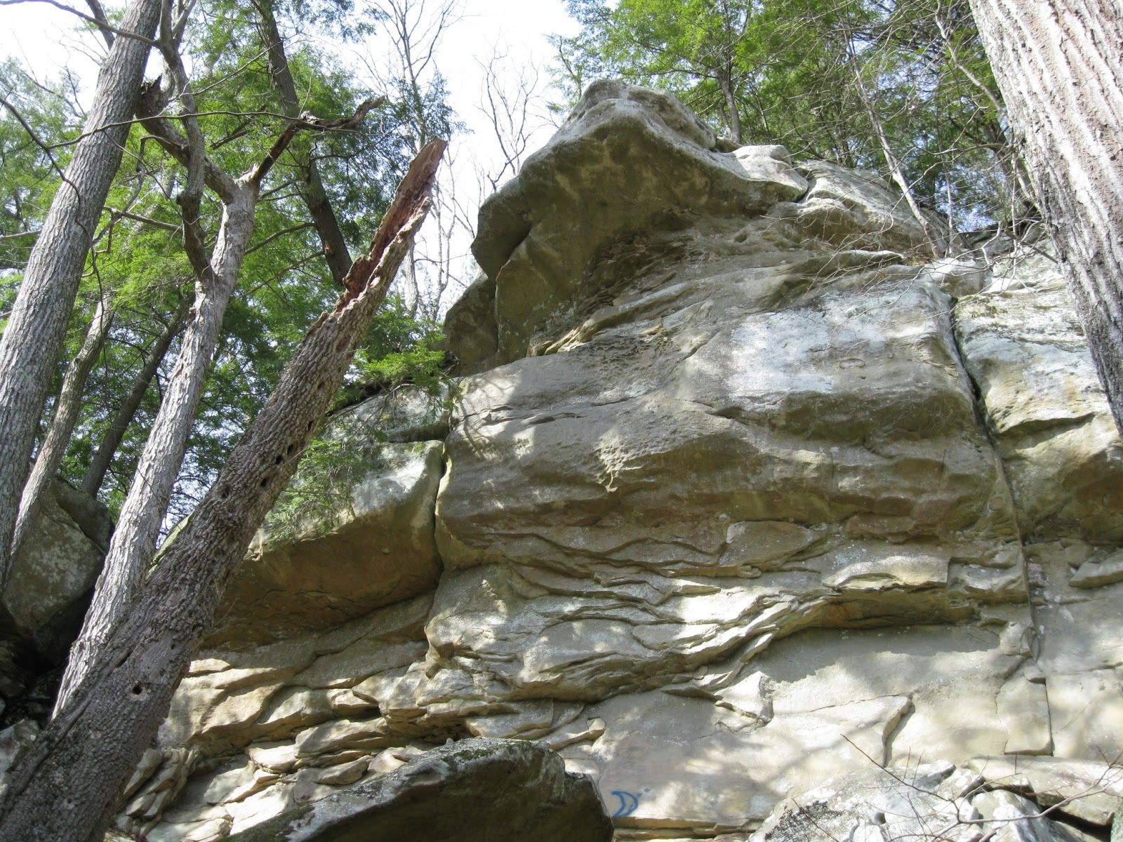
After admiring the dam, we got back onto Overlook, where we walked alongside the Hughes River for a bit, and then went inland among huge boulders.  Along the way we saw a trio working their way up a rock face. After passing the rock climbers, we went through a rock tunnel, and just saw more neat rock scenes than anywhere else.  Why does no one know about this fantastic hike?

After the rocks, it was up, up, up through deciduous woods until we arrived at our car.  Total distance for Overlook was 1.2 miles, and the Lake Trail bit was an extra mile added on.


Saturday, March 9, 2013

Tygart Lake SP

Today, Cool Guy and I planned on a return trip to Valley Falls SP, his favorite.  The plan was thwarted when we arrived and the gate was closed.  It was surprising.  I double checked my brochure and there was no mention of seasonal closing, no signs posted, nothing.  Well, we weren't going to have driven 2 hours for nothing, so we drove on over to Tygart Lake, which wasn't too far away.

The weather was at least 10 degrees cooler there than at home.  I had a hat and mittens and I needed them.  My heavy sweater was just right after we started hiking.

The lodge at the park was very nice, with the entire back side of it being windows overlooking the lake.  It was a lovely sight.  Someone working there was familiar enough with the trails to give us some guidance, which was much appreciated, as we were doing this on the fly.

We began with the Dogwood Trail which went straight up, up, up until we reached the ridge top.  The trail was well-blazed, but there was an incredible amount of trees and branches down, and it was pretty rough going in places.  At the ridge top, there was one open expanse which had a nice view of the valley beyond.  Then it was down, down, down, crossing rivulets of snow melt, scrambling over fallen trees, all the while enjoying our solitude outside in soft weather.

At the bottom of the hill, we crossed the park road and began the Dam Trail.  It was very level, but a lot mushier, being at a lower elevation.  Nonetheless, it was a pleasant hike with woods on one side and the lake on the other.  The trail terminated at the dam with an overlook of the lake and the dam and some benches where we could have our lunch.  Dams just don't thrill me.

Cool Guy went down to the lakeside after we had eaten and just messed around.  When he came back up, he was bothered by the amount of trash around the lake: old tires, beer bottles, paint cans, and the like.  To finish up the hike we doubled back on the dam trail and then went further on it, past the lodge until we reached our car again.  Cool Guy pointed out to me all the trash on the sides of the trail.

If Tygart doesn't have a clean up program, I hope one can be started.

Despite the trash, despite the change in plans, it was a good day, perhaps because it was a saved day after all.


Thursday, March 7, 2013

Hibbs Cemetery, North Bend SP


During a week in mid-February, I was at a quilt retreat at North Bend State Park.  Luckily, the weather allowed a little hiking in between snow storms.  On Feb. 18, one of my quilting buddies, Nanny, and I hiked the Hibbs Cemetery/Nature Trail loop.  Total distance was about 2 miles.  The day was the warmest of the week, nearing 50 degrees.

The Hibbs Cemetery Trail begins right behind the North Bend Lodge.  It immediately goes up and does a little up and down.  This wouldn't have been a problem except for two things: first the ground was pretty muddy and slippery, and second, there were a lot of trees, branches, etc. blocking the trail, making it necessary to do quite a bit of scrambling, and this on muddy, slippery ground.  However,  after the initial rough going, we reached the top of the ridge, and then the debris was not as bad.

We were rewarded with some fantastic rock formations, not to mention the peace of being outdoors in the the clean, clear air.  The trail was mostly through woods, and there wasn't any view to speak of, but this walk in the woods was lovely in its own way.

The trail, according to the map, goes by the cemetery of an early pioneer family in the area.  We reached the end of the trail and saw nothing.  Sure that we had just been too busy gabbing to notice, we turned around to look again.  About where we guessed it should be, sure enough there was the sign for the cemetery, but it was lying face down on the ground.  We propped it against a tree and searched in vain for headstones.  There were none.  Asking the ranger afterwards, we learned that there are no headstones, the cemetery is just that flat piece of ground. 

On the way back, we took a section of the Nature Trail and got to see new sights.  It ended at the road to the lodge, and as we were walking back, we saw some horsemen getting ready for a ride on the trail.

Overlook Trail, North Bend SP

While at quilt retreat, I was fortunate enough to go on two hikes.  The second, done on Feb. 21, was the Overlook Trail.  We - Nanny, Charlie, Becky, and I - had to drive in Becky's new truck to the cabins to begin our hike.  It was cold out there, but the sun was shining.  It was definitely worth the time and trouble.

Overlook began with a descent and wound through woods, but round a corner, there would be a fantastic rock formation, or a view.  The point of this trail was to wind in and out around the Hughes River and finally to reach an overlook of the dam.  The hike and the river were fantastic, but the dam was just a dam.

In general, the trail was well-blazed, except around the dam area.  If it weren't for Becky and her amazing sense of direction, we might still be wandering around trying to find our way out.  Going out, we hiked through more woods, crossed a stream, and in general just had the nicest of times.  I plan on taking the family there soon.


Thursday, February 28, 2013

Ohio River Islands Upland Trail

Cool Guy and I did the Upland Trail of Ohio River Islands Wildlife Refuge on Feb. 15.  It was cold and spitting snow.

The trail began straight up and wound through the hills in the area.  One big difference between this trail and the riverside one was that this trail was much more primitive.  Actually, I enjoyed it more.  It was almost exclusively a woods trail.  Not much of a view to speak of, no big water interest, just woods.  But they were pretty woods, even in the winter.  We crossed several small ravines and had several nice woodsy scenes.  There wasn't a lot of up and down after the first up, just a lot of meandering until it was time to come down.

The trail was well-blazed, and a really nice perk was that several trees were identified for us.  I especially remember the Virginia Pine, and I think I could identify that myself now.  Cool Guy was most impressed with the poison ivy vine (id'd) that was a thick around as my wrist.  Glad it was winter.  We don't like poison ivy.

The trail was about a mile in length, with a shorter loop or figure 8 option that we didn't take.  Next time....